Ukraine air raid alert map
Alerts by oblast and district, drones and missiles on the map in real time. And the Air Alert Map app sounds a siren when your district is under alert, even when the app is closed.
Free · iPhone and Android · Ukrainian and English
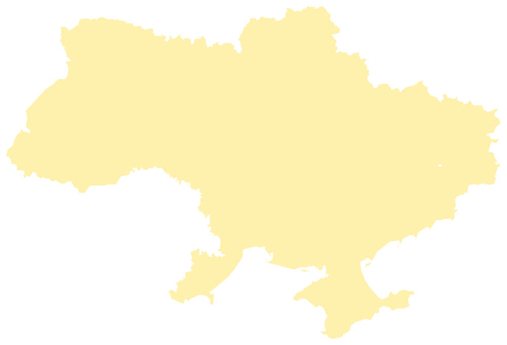
Air raid alerts now
Loading data…
- Alert
- No alert
- Temporarily occupied
Data: NEPTUN
Not an official source. Air Alert Map collects data from open sources; it may arrive late or contain errors. Always act on official air raid sirens and instructions from the authorities. Official “Air Alert” (Povitriana Tryvoha) app
Regions
Alerts by region
A page for every region: live status of all its districts, the map and the official shelter maps.
- Cherkasy Oblast
- Chernihiv Oblast
- Chernivtsi Oblast
- Autonomous Republic of Crimea
- Dnipropetrovsk Oblast
- Donetsk Oblast
- Ivano-Frankivsk Oblast
- Kharkiv Oblast
- Kherson Oblast
- Khmelnytskyi Oblast
- Kirovohrad Oblast
- Kyiv City
- Kyiv Oblast
- Luhansk Oblast
- Lviv Oblast
- Mykolaiv Oblast
- Odesa Oblast
- Poltava Oblast
- Rivne Oblast
- Sumy Oblast
- Ternopil Oblast
- Vinnytsia Oblast
- Volyn Oblast
- Zakarpattia Oblast
- Zaporizhzhia Oblast
- Zhytomyr Oblast
The app
Everything that matters during an alert
Air Alert Map watches your district and the threats nearby, so you have time to reach a shelter.
District-level map
Alerts for every oblast and district of Ukraine, updated live.
Live drones and missiles
Shaheds, cruise missiles and aircraft on the map; each marker shows the direction of travel.
A siren, even when the app is closed
Siren notifications for your district, and an all-clear when the danger has passed.
Quiet hours
At night the app only disturbs you for direct threats.
Your family’s districts
Follow alerts where your family and friends live.
Official shelter maps
Quick links to the DSNS, city and Diia shelter maps.
Screenshots
What the app looks like
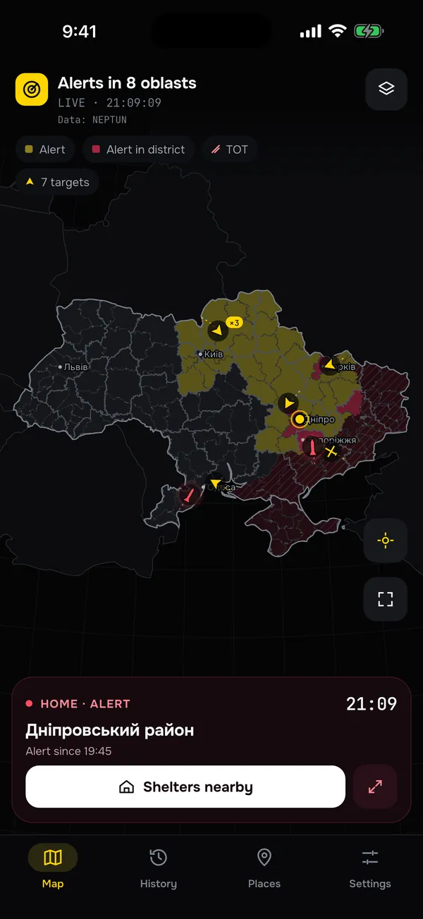
Live alert mapEvery oblast and district 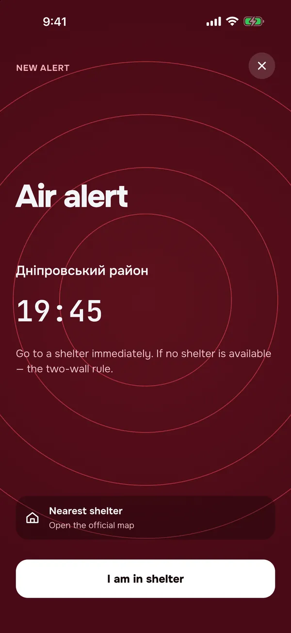
Full-screen sirenWhen your district is under alert 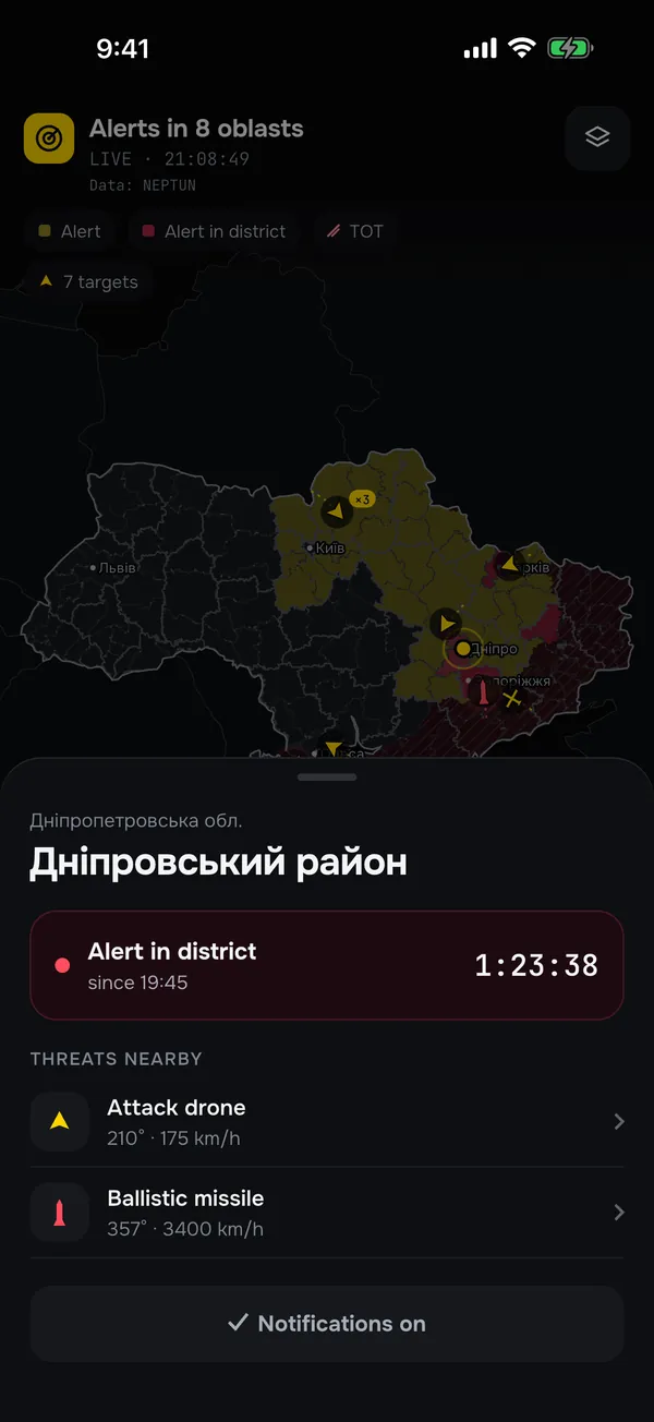
District statusHow long it has lasted, threats nearby 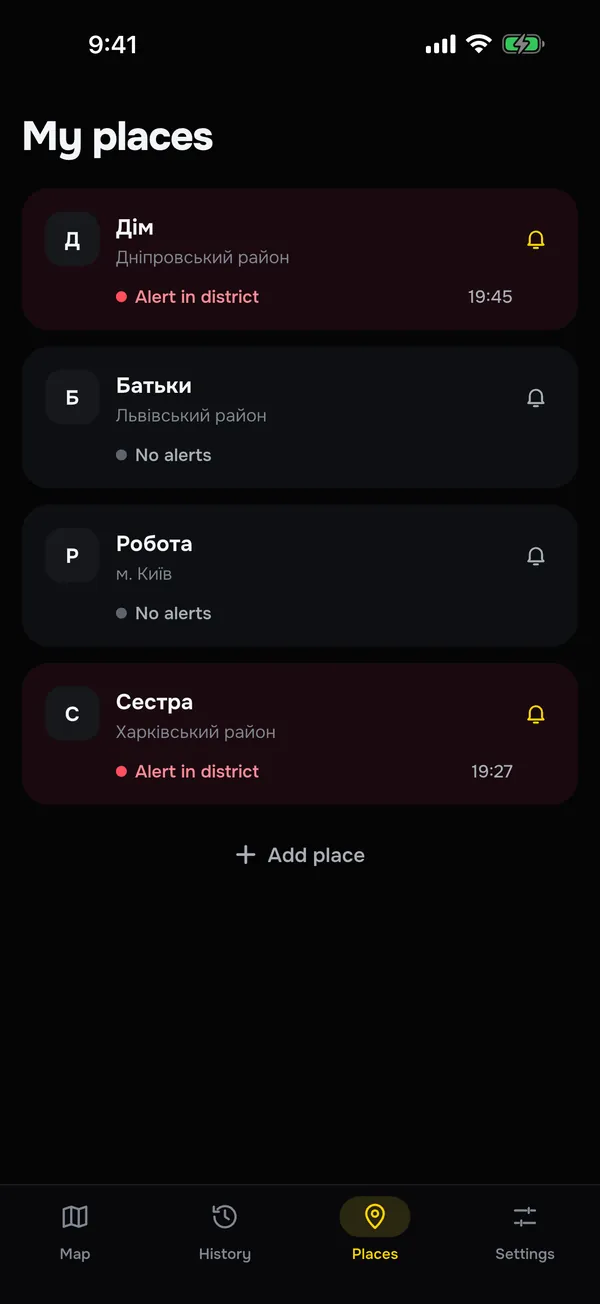
My placesHome, family, work 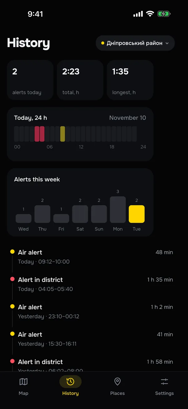
7-day historyWhen and for how long 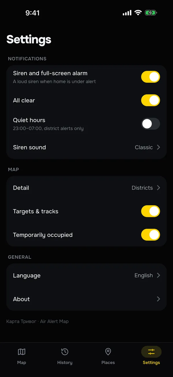
Quiet hours and all-clearNotifications your way 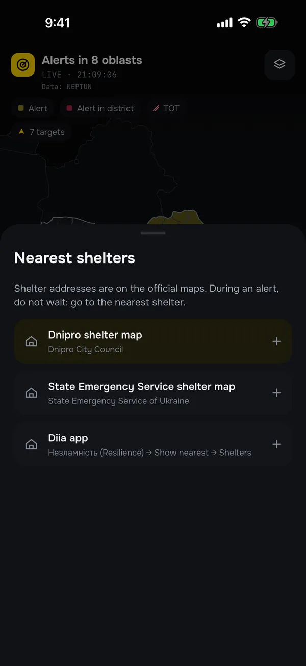
Shelter mapsDSNS, cities, Diia
How it works
Ready in a minute
- 1
Install the app
Air Alert Map is free for iPhone and Android.
- 2
Set your home
Allow location access or pick your district by hand.
- 3
Get alerts
A siren for your district, the all-clear and threats nearby, even when the app is closed.
Sources
Where the data comes from
We don’t declare alerts ourselves: we show data from open sources and always name them. The current sources are also shown next to the map.
- Ukraine Alarm
The official API of the Air Alert (Povitriana Tryvoha) service: alerts by oblast and district.
- NEPTUN
Monitoring of airborne threats: drones, missiles, aircraft.
- Boundaries and territories
District boundaries: OpenStreetMap, GADM and Natural Earth. Temporarily occupied territories: DeepState.
Air Alert Map is not an official warning system. Always act on sirens and official alerts. Official “Air Alert” (Povitriana Tryvoha) app
Is this an official app?
No. Air Alert Map is an independent project, not affiliated with any state body. The data comes from open sources and may be delayed. Always act on sirens and official alerts, for example in the official “Air Alert” app.
Where does the data come from?
Alerts come from the official API of the Air Alert service (Ukraine Alarm) and, if it is unavailable, from NEPTUN. Airborne threats come from NEPTUN. The current sources are always shown next to the map.
Will I get an alert when the app is closed?
Yes. Push notifications arrive even when the app is closed: with a siren sound for your district, and an all-clear notification when the alert ends.
What are quiet hours?
A night mode (23:00–07:00) that you turn on in the settings. During these hours the app only notifies you about direct threats.
Can I follow more than one district?
Yes. Add the districts where your family or friends live and get their alerts too. Saved places show their current status at a glance.
How much does it cost?
The app is free with ads. Every alert stays free. If you like, you can remove ads or subscribe to PRO or Patron.
What does the app know about me?
Location is only used to find your district; the coordinates are not sent to our server. See the privacy policy for details.
Where can I find the nearest shelter?
The app links to the official shelter maps: DSNS, Diia (Незламність → Укриття) and city maps.
Does the website work without the app?
Yes. The map on this page updates live in any browser. The app adds notifications, a siren and settings for your district.
Get Air Alert Map
Free for iPhone and Android. A siren for your district, even when the app is closed.
Coming soon to the App Store and Google Play: the app is already in store review.
Point your phone camera here to download